PHASE 2,
COLORADOWOO HOO!! This is the day I get to see my wife! But alas, her flight doesn't arrive until early evening.
So I guess more riding is in order. The plan was to meet with a couple local members of the FZ1OA and a friend of theirs at Starbucks at some forgotten time around 8:00. Since I seem to wake up with the sun like it or not I arrived a little early. When I got there Tony was already there so we introduced ourselves and soon after Tina and Mike showed up and the four of us were headed north on hwy 287. You can drive from Denver to Fort Collins, about 50 miles away, and never realize you left Denver. Once we got to Fort Collins though we turned west on hwy 14 and had a great ride through the Poudre Canyon. I wish I had taken some pictures here, but we were having too much fun on that twisty road to stop for pics. In Walden we turned south on 125, rode to 40, then north on hwy 34 and into Rocky Mt. N.P. In the park there was some road construction, but not too bad. I also saw a campground that I didn't remember seeing the last time I came through the park about 7 years ago. Then I realized that the entire campground had been clear-cut because the pine beetle that the guy in Twin Lakes told me about had killed them. Somewhere around the top we saw a Big Horn Sheep that made me do a double take. I've seen these animals before in South Dakota, but they were not much bigger than a domestic sheep. This one stood as tall, if not taller, than a deer! After the park we followed hwy 36 back to Longmont where we said our goodbyes and I hit I-25 south to get to the airport in time to greet my wife. Thanks Tina and Mike for your hospitality and a great ride.

I have to digress for a moment. If you've never been to the Denver airport this will mean nothing to you, but I have a question for any of the locals who may read this. What the hell is up with the giant, blue horse with red lights for eyes? That has got to be one of the most paganistic statues I've ever seen.
At any rate, I pulled into the pick up area and my wife had been standing there waiting for all of 10 minutes, great timing. We left the airport, went to our room, and the rest of that story doesn't really belong here.
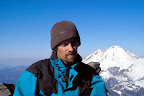
We were both feeling rather lazy and didn't check out of our room until 11:00. Eventually we were packed up and headed to Mt. Evans, the highest paved road in the country. Or so they claim, I've heard of at least one other road in Colorado that makes the same claim. At 14,264 feet it was definitely the highest my fizzy has ever been and the second highest I've ever been without an aircraft involved. As we neared the top we saw a large black thunder cloud closing in on us so we decided to hurry to the top, take a few pics, and get the hell off the mountain.

Our departure from the summit was a little delayed when I realized there were other pics to take as well.

Finally off the mountain and back in Idaho Springs we decided to stop at the Tommyknocker Brewery for lunch.

At this point we still were not sure if we wanted to go north or south, so we decided to find someplace around Frisco to spend the night. That way in the morning we could head either direction on hwy 9. When we got to Frisco we went to the visitor’s center and asked about camp grounds. They told us of a couple places and based on their advice we chose a campsite on Dillon reservoir. After setting up camp

Kriss got to talking to our neighbors Tom and Steve. By the time I joined them they had fed Kriss and were shoving a plate in my hand. It was incredible; they managed to cook a meal in a campsite better than anything I could dream of at home. These guys were both social workers from the Colorado Springs area and had been friends for years. Of even more interest to me as a mountaineer, was that they had climbed over thirty fourteeners together. So we talked well into the night, and they told us to be sure and look them up when we get to Colorado Springs.
Here's another pic from the campsite.
 7/13/9
 Today we decided we would head south, so we packed up, said good by to our new friends, and were off. We stopped in the beautiful town to Breckenridge for breakfast and then were chased by T-storms over Hoosier Pass.
Our first intended stop was Florissant Fossil Beds National Monument. Unfortunately the T-storms that had been chasing us all day caught up with us as we were getting fuel in Florissant, so we hauled azz to Manitou Springs. As it turns out there is no tent camping near town and with a storm fast on our tail we decided to get a room for a couple nights. Moments after unpacking the bike the storm unleashed its fury and all hell broke loose. Lightning bolts all around and rain literally pouring out of the sky.

About half an hour later the sky cleared and it was a beautiful sunny day again. So Kriss and I walked around town window shopping.
Manitou Springs turned out to be a pretty cool little town. Walking around town we saw little round brick buildings here and there on the sidewalk and were curious, so we found a window and looked inside. Inside you could see that it was a spring. There was a walkway around the outer edge of the room and a pool in the middle. It was too dark to get a picture of the inside, but here's one of the outside.

Here's Kriss playing in another random spring in town.

They also have a video arcade that spans several small buildings and the outdoor walkways between them. There weren't a whole lot of real modern games, but there were quite a few of the games I remember as a kid and many that were long before my time.


We played video games and walked around until the town was sleeping then decided to do the same.
7/14/9 We started the day by gearing up and riding to the Garden of the Gods. When we got there we realized it was so close to our room that it would have taken less time to walk than it did to put on all the gear. This park reminded me of Utah quite a bit.


Here's one of Kriss modeling an interesting formation.

I like the contrast between the orange of one rock and the powdery white of the other.

This scrub jay tried to elude me, but I managed to get a half way decent shot.

Doing a little bouldering.

After sweating all over the Garden of the Gods we put all our gear back on and headed over to Manitou Cliff Dwellings. This was the first example of cliff dwelling I had seen and at first I was surprised to see the small scale of the place. It almost seemed like a model of cliff dwellings since the rooms were only about 4' high.


Looking closely at the wall you can see shards of pottery that were added as they built.

In this picture you can see two rooms one on top of the other with the horizontal log representing where the floor/ceiling used to be.

A couple close ups.


This was a rather difficult picture to take. Looking down into what used to be an oven. They would build a fire in the small circle in the center of the oven. The square hole in the wall near the center of the picture is where air would enter from outside, and the rock standing between them was to prevent direct gusts from effecting the fire. In use, the entire oven was covered with a dome to hold in the heat.

There was a narrow hallway behind the rooms that connected most of them.

I thought this was an interesting window.

We went to the Stagecoach Inn for lunch simply because they advertised that they had over 20 local brews. Sounds like my kinda place. They also had the largest ravioli I've ever seen, tasty too.

Later in the evening we walked all over downtown and the residential hillside. Along the way we stumbled upon Miramont Castle.


Built almost entirely of stone in the 1800's and recently saved from demolition by the Manitou Historic Society. Unfortunately they were just closing as we walked in so we would have to wait until morning to visit.
7/15/9 We went to the castle first thing in the morning and were completely disappointed. As interesting as the outside was, the inside wasn't much more than a collection of porcelain dolls. Needless to say, we didn't stay long.
At this point I had been concerned for several days about the impending demise of my rear tire. A member of the FZ1OA who lives in Denver had made the generous offer of using his address to ship a tire. He even offered to let me use his parking lot to remove the tire and his truck to take it to the shop. I on the other hand dropped the ball and waited until I was desperate and many miles away. So priority #1 for the day was to find a decent shop and get an appointment to get it fixed. After asking the locals for suggestions I ended up at Apex Sports. I explained my problem to the maintenance manager and was surprised to find that they could get me in first thing in the morning. My next step was to bend over the parts counter for the tire. Once again I was quite pleased, their prices were very reasonable for a stealership. The PR2 was about $20.00 more than I found it for online, and about $80.00 less than my local shop sells it for. I opted for the BT 021 for $153.00.
With that squared away I decided that a ride to Royal Gorge wouldn't be too much for the tire. Boy was I wrong. After getting down there and realizing that they wanted $24.00 each just to walk across a friggin bridge, we returned to Colorado Springs and hooked up with Rachel, a friend of Kriss' that offered to let us set up our tent in their back yard. Here's a shot of my tire when we got to their house.

That may well be the second dumbest thing I've ever done on a bike. The dumbest being when I was 16 riding an FJ600 with a perpetual oil leak that kept the rear tire nice and lubed.
Later that evening we went for a walk to a local pub called Bennies. Turns out they had an open mic that night and amazingly enough, everyone who got on stage was pretty damn good. While there we met Santa Clause in the off season. He was a very talented Bluegrass singer/guitarist who goes by the name of "More or" Less. This man not only looks just like Santa, but has the jovial personality to go with it. He told us of a Bluegrass festival in Florissant and invited us to camp with him, which we gladly accepted and told him we would see him there.
We saw this little guy on the overpass while walking back to Rachel's house. I think he's a gopher snake.
 7/16/9
 I got to the shop at 9:00 sharp and the mechanic directed me to the break room where I sat waiting with a magazine and some coffee. I ended up sitting there until 10:45, but the wait was bearable thanks to the "geriatric day care." That's what the service tech called the group of 70+ year old men with nothing better to do than spend their mornings sitting around the local bike shop seeing who can tell the biggest lie. It was quite entertaining.
With the stress of the dead tire gone and me once again able to relax and enjoy the fact that I was on vacation, we decided to track down the Rocky Mountain Motorcycle Museum. I learned real quick that Colorado Springs is really spread out. By the time we got as far north as the museum it felt like we were half way back to Denver. The museum is housed in a tiny little building that at first looked like a part of the Harley Shop right behind it. For such a small building it had a fair number of bikes. I even learned that Bridgestone used to make motorcycles but they gave it up to concentrate on tires. Unfortunately it was shoe-horned in so tight behind other bikes I couldn't get a picture. Here's a few I did get.


It was fun, but in the end it took longer to find the museum than it did to walk through it.
After the museum Kriss and I called Tom, one of the guys we met camping, and agreed to meet him at Phantom Canyon brewery at 7:30. Since it was only 3:30 at the time we decided to see if we could find Bristol Brewery. We started out by walking about a mile in the wrong direction before realizing our mistake, turning around, and walking 2.5 miles the right way.
Along the way we saw an interesting, even if a bit morbid, piece of art.


We also came across this spinning fountain at one point.

By the time we got there we had about enough time for one beer before we had to head back out the door to meet Tom and his girlfriend. While I found Bristol's IPA to be ok, I really liked what Phantom Canyon had. Their food was even better, I had the Sea Bass. After dinner I nearly had to do battle with Tom just to be able to leave the tip. He was a really good guy, thanks again for dinner.

 7/17/9
 On our last morning in Colorado Springs we took our hosts to breakfast and then rode the short distance to Florissant. Since we were several hours early for the music festival to start we decided to go see Florissant Fossil Beds.
Just outside of the Fossil beds there is an old homestead that looked interesting so we stopped and took a few pics.


The root cellar.

When we got to the fossil beds we realized that there were 14 miles of trails to hike but as much as I love hiking it was just too damn hot to do more than half a mile. The good news is that the best fossils (huge sequoia stumps) are in that first half mile.


The Florissant Fossils is the name of "more or" Less' band and also the opening act for the bluegrass festival. These guys were a lot of fun, and very talented. I also noticed a picture on the wall of the bar hosting the event of a guy in a Santa Clause suit and a couple kids on his lap. Sure enough it was our new friend "more or" Less and the caption at the bottom of the picture said "Price Less". Yeah, it may seem kinda cheesy, but they where some really good people and my musician wife always loves the opportunity to hang with others of her kind.
Here's a pic of the Florissant Fossils. Can you guess which one is Less?

Somewhere along our travels Kriss and I heard about an eclectic little town that once elected a cat for mayor. To say Guffy was odd would be a bit of an understatement. These two pics are pretty indicative of the entire town.


After taking pictures of Guffy we went south on hwy 9 to 50 and then west to Salida where we stopped at Amicas for lunch.

While there we met a guy riding a TDM 850. When we told him we were headed to Crested Butte he couldn't say enough good things about Cottonwood Pass. He even assured me that the gravel portion is not too bad. So I figured why not?


Once we got to Almont we set up our tent

and headed out to find Crested Butte Brewing. Alas, it was not to be, turns out they had been out of business for years. On the other hand, we did manage to find a great little pizzaria with a great selection of beers, my favorite being the Dogfish Head 90 minute. I recently found this beer in a local grocery store selling for $15.00 for a four pack!!!, and it's worth every penny.
After dinner we walked around town for a couple hours doing a little window shopping, then got on the bike to head back to camp. Just as we were leaving town I noticed out of the corner of my eye a large dark figure turn into an alley. As dangerous as it was, I knew Kriss had never seen a wild bear before, so I looped around the building and found an angle where she could see it without getting any closer than about a block away. It was the first time I'd seen a wild bear wandering around the middle of a town. It made me wonder if the locals would freak out, or if this sort of thing is commonplace?
7/19/9 On our way to the Black Canyon of the Gunnison we stopped in Curecanti National Rec Area.

I was reading the touristy little info boards that they had there and one of them mentioned that the rock in the canyon is some of the oldest in the world at a billion years. Well, me being the geology nerd...I mean student... that I am, I just had to take a piece of it home. It's now the oldest rock in my collection.
There was also this old train on display in the parking lot.

When we finally got to the Black Canyon we started out riding the South Rim. As you can see, the scenery is stunning.


After seeing what the South Rim had to offer we decided to take the East Portal Road. This road runs for 5 or 6 miles, has a 16% grade and one hairpin turn after another. Going down is hell on the wrists, but coming back up is well worth it.
7/20/9 On Monday morning we headed east on hwy 50, then turned north on hwy 24 and rode to Edwards where we stopped at the Gore Range Brewery for lunch. It was our intention to spend the night in Vail, but the town was so crowded with people that we couldn't find a place to stay. Not only that, but it turns out that Lakota Chops and Hops Brewpub had been closed, and with no brewpub, how would we get dinner? So we continued on to Dillon. This was one of the few times I was on a freeway during this trip. We rode from Vail to Dillon on I-70 and thanks to construction that 35 miles only took about 1.5 hours. Hotter than hell on a freeway at < 5 miles an hour sucks balls and is one of the many reasons I avoid freeways.
After finally arriving in Dillon we checked into a Super 8 and walked into town to see if we could find the two brewpubs reportedly there. We had no problem finding Pug Ryan's Brewery and Steakhouse.

But Dillon Dam Brewery was a bit more elusive. The brewery is located at 100 Little Dam Road and we walked quite a ways on Dam Road before realizing our mistake. We finally asked a local where the damn Dillon Dam Brewery is and found that it's about a block from our hotel.

We finished a late dinner and a few brews then walked back to the hotel to call it a night.
In the morning we decided to go to Breckenridge. Kriss and I are both very frugal people, her more so than I, and hence the reason for camping. But since this is our second anniversary we wanted to treat ourselves to a nice room in a town with plenty to do. We were hoping to do that in Vail, but it just wasn't what we were looking for. Breckenridge turned out to be perfect for the occasion. One thing I learned on this trip is that when you arrive in a new town the easiest and quickest way to get acquainted with it is the visitors center. Breckenridge was no exception. The very nice lady at the visitor’s center hooked us up with a B&B just 3 blocks from down town for only $88.00 a night.

After staying here I will definitely be considering bed and breakfasts more often. It was the first time in two weeks that I had internet access from a real computer, and one of the best breakfasts I had on the entire trip.
Once we were unpacked and settled into our room we headed out to explore the town. Kriss is such an extroverted person she makes new friends everywhere she goes.

I think she liked this one a little too much though.

Kriss modeling the latest in stone wear

Eventually we made our way up to a hiking trail that leads up the side of the hill next to town for a better view.


After a refreshing hike we made our way back into town to find a refreshing beverage and dinner. Breckenridge Brewery was just what I was looking for.
 7/22/9
 Since Kriss had never seen Rocky Mountain N.P. we decided to head in that direction. We rode hwy 9 north to Kremmling and then turned east on 40 to 34 east. Once we reached Grand Lake we stopped for an early Lunch at Grand Lake Brewing Co.

I think Kriss was a little freaked out by all the beetle killed trees, she took plenty pictures of them.

And then the road construction begins.

Actually since I had just ridden through here about a week and a half ago I was expecting construction, but it was a lot worse this time.
Kriss is getting better all the time at taking pictures from the back of the bike.


I've never been through this park without seeing elk.

Unfortunately we didn't see the bighorn sheep this time.
Yet another local FZ1OA member had told me of a place in Lyons called Oskar Blues. As it turns out this place is also a brewpub, so me being a lover of beer and my wife being a blues musician, we had to check it out. But first we stopped at Estes Park Brewery so I could get a sample of their IPA and a coaster for my collection.

When we got to Lyons we found out that there was a big bluegrass festival that weekend and even though it was only Wednesday the entire town was full. No lodging and no where to pitch a tent. Since it was getting late and we weren't sure how much further we would have to ride we decided not to visit Oskar Blues.
Continuing on we ended up in Longmont in the sleaziest hotel I've seen in years. It was cheap, but still way more than it was worth. Unfortunately it was the only thing we could find. The upside was that the Pump House Brewery was just down the road and it had a nice atmosphere with good food and beer.

On Thursday morning we rode the short distance from Lyons south to Boulder. I had spent a couple days in Boulder once years ago and was excited to show Kriss the Pearl St. Mall and its street performers. So we got a room at the Boulder University Inn and walked the three blocks to Pearl St.

Here video would be nice, this guy flipped his hat off his foot while riding a unicycle and caught it on his head, not bad.


Pearl St. also has some interesting artwork


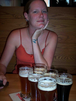
One thing I didn't notice on my last visit, whether because I wasn't interested or it wasn't the case in 02 I don't know, was the abundance of microbreweries in Boulder. I found a flyer in a visitor’s center somewhere along the way titled CO Front Range Breweries and it lists 9 in the Boulder area. At least four of these places are either on Pearl St. or within a block, so as we staggered from one to the other I took the last several pics and we finally made it Mountain Sun Pub & Brewery for lunch.

We figured since we didn't have to go anywhere we might as well get one of those sampler trays and try all their beers. After all, I prefer IPA's and Kriss prefers porters and stouts. I don't think either of us figured it would come with schooner size glasses.
Not only did they have good beer, but damn that was a good burrito.

We had started this whole Boulder beer tour at about noon and by the time we had finished lunch and visited the four breweries within walking distance we could barely walk anymore. So we went back to the hotel room to take a short nap before going back out on the town. Eventually we went back out and walked around Pearl St. some more. We saw the same shops selling the same goods, and the same street performers performing the same acts, but I simply couldn't drink another beer whether it was the same or not. I actually hit overload and couldn't look a beer in the face. So we went back to the Walnut Brewery for dinner and a tall glass of water.
 Friday 7/24/9
 This was to be Kriss's last day in Colorado. Her flight was scheduled to leave Denver airport at 8:00AM Saturday morning so we are hoping to make the most of it. After checking out of the hotel the first thing on the agenda was to ride up into the Flatirons. I drove up here the last time I was here in 02' and thought it would be another cool place to take Kriss. The view was great.

Sorry, I meant the view of Boulder.

After the Flatirons we rode back into town and went to the Boulder Beer Co for lunch. We each had a modest lunch and still being a little burnt out on beer we just had a sampler of our favorite types, me the IPA and Kriss the stout, and I got another coaster for my collection.

On our way out I noticed a flyer on the wall that said there was a brew fest going on in Denver on that very day, and since we had to go there anyway we decided to check it out. We rode into Denver and went to the visitor’s center downtown. I asked Kriss to wait by the bike while I go in to find out how to get to the brew fest and other info. When I came back out a taxi was double parked and had me blocked in, so I put my wallet on my tank bag and proceeded to put on all my gear and get on the bike in a manner that is completely different than my normal routine. I think that is the reason I ended up riding away without ever putting my wallet in my jacket pocket. We got to our hotel to check in about 45 minutes later and that was when I realized it was gone. I called the visitors center with no luck and for some silly reason I ended up riding back downtown to see if I could find it. Yeah, right, I'm going to find a lost wallet in downtown Denver, that's logical. Finally I gave up and went back to the hotel. I was so upset with my idiotic move that it was making me sick to my stomach. I called my bank and credit card companies to cancel cards and found that in the first hour after loosing it someone had charged $300.00 to my credit card and over $200.00 to my debit card. The good news was that Kriss hadn't left yet so I could use her debit card to access some money for the trip home. The bad news was I only had about $400.00 left in my checking account, $200.00 of which some asshat had just spent leaving me with only $200.00, and no backup. If this had happened after Kriss went home with her debit card I don't know what I would have done. I guess I would have been asking local FZ1OA members to let me pitch a tent in their yard while I wait to have money sent to their address? You can't wire money to someone with no ID after all.
After all this neither of us was up to a brew fest and with the way my luck was going they probably would have carded me anyway. So we just went out for a nice quiet dinner and went to bed.
Stay tuned for Part 3: my ride home.